Pressemitteilung —
GAF, GeoVille, SIRS and e-GEOS contracted by the European Environment Agency to implement the Copernicus Land Monitoring Service — High Resolution Layers 2015
The European Environment Agency (EEA) has recently contracted GAF AG and its international partners to implement the update of the Copernicus High Resolution Layers (HRLs) Imperviousness, Forest, Grassland, Water/Wetness and Small Woody Features in the frame of the continental component of the Copernicus Land Monitoring Service (CLMS).
Munich, December 14, 2016
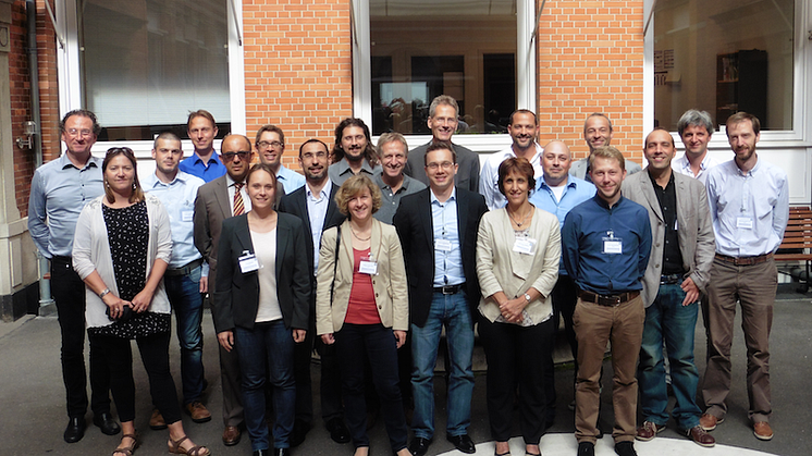
Three leading European geo-information service companies – GAF AG (Germany), GeoVille GmbH (Austria) and SIRS SAS (France) – have joined forces to serve Europe’s need for consistent mapping and updating of all five High Resolution Layers (HRL) 2015 on land cover characteristics for all of Europe. Complemented by e-GEOS S.p.A. for grassland mapping, the joint team has conducted a successful Kick-off Meeting together with EEA, the European Space Agency (ESA) and the European Topic Centre on Urban Land and Soil Systems (ETC-ULS) in Copenhagen end of August 2016. Framework Service Contracts with a total volume of up to eight million Euro have been signed. The main production will run within a 12 to 18 months time period.
Based on high to very-high resolution satellite imagery, including ESA’s Sentinel-1 and Sentinel-2 satellites, the team will perform an update and change mapping of the High Resolution Layers “Imperviousness” and “Forest”, as well as a new mapping of “Grassland”, “Water and Wetness”, and “Small Woody Features” for the EEA-39 countries (approx. 6 million km²). All thematic Layers provide dedicated information on current environmental conditions and change trends of the major land cover / land use types at 20 m spatial resolution. In complement to the well-established CORINE Land Cover (CLC), the HRLs will serve a broad user community, including European administration as well as Member State institutions, supporting applications for environmental policies and political decision-making. All final products will be made freely available by EEA via the CLMS portal (http://land.copernicus.eu).
About Copernicus Land Monitoring
Copernicus, previously known as GMES (Global Monitoring for Environment and Security), is the European Programme for establishing a European capacity for Earth Observation (more information at http://www.copernicus.eu). The objective of its Land Monitoring service is to provide users in the field of environment and other terrestrial applications with consistent and up-to-date information based on space data and other sources. It addresses a wide range of policies such as environment, regional development, agriculture, transport and energy at EU level, as well as European commitments to international conventions. It comprises three main elements: the global, the continental (pan-European), and the local service components. Information, data and products of the Copernicus Land Monitoring Service is accessible at http://land.copernicus.eu.
Themen
Kategorien
About GAF AG
GAF AG is an e-GEOS (Telespazio/ASI) company seated in Munich, Germany. It is a leading solutions provider with an international reputation as skilled and reliable supplier of data, products and services in the fields of geo-information, satellite remote sensing, spatial IT and consulting for private and public clients. GAF is one of the most experienced European service providers in the EU/ESA Copernicus programme and covers all thematic domains: Land, Marine, Atmosphere, Climate Change, Emergency Management and Security. GAF further provides solutions in the sectors of Agriculture & Food Production, Environmental and Water Management, Forestry and Climate Change, Infrastructure and Mobility, Land Management, Insurance and Asset Management, Mining, Oil & Gas, Telecommunications and Network Planning, for Space Agencies & Satellite Operators as well as Defence and Security. Since 1985, GAF AG has successfully completed more than 1,000 projects worldwide. Further information is available at http://www.gaf.de.
About GeoVille GmbH
GeoVille is a private sector enterprise founded in 1998 and is based in Innsbruck, Austria. It is an internationally operating company, providing consultancy, services and products related to Earth Observation, Geo-information and Geographic Information Systems. The company has a longstanding experience in information service provision in the field of land and environmental monitoring. Our customers stem from private industry sectors, public organizations and research institutes. Since its foundation, GeoVille has successfully carried out more than 400 projects in more than 120 countries worldwide. GeoVille’s focus is on the integration of satellite earth observation based information and in-situ data in order to provide assessment and monitoring services. GeoVille enables geographic accounting of human and natural dynamics through a satellite’s eye, adding the spatial dimension to information gathering, analysis and monitoring, for policy support and informed decision making. Further information is available at http://www.geoville.com.
About SIRS SAS
SIRS is an independent private company and a French Earth Observation (EO) Service Provider founded in 1989 specialising in geographical information production as input to Geographical Information Systems (GIS). Over the last 27 years, SIRS has acquired significant capacities in developing operational services and managing large-scale EO production projects. SIRS’s main activities are in the fields of land cover/use mapping for urban planning and environmental monitoring, Habitat cartography (Natura 2000), Agricultural monitoring and Crop inventory, Defense geographic data production, Forestry inventory and cartography, tree management. SIRS has been involved in a number of large international EO based projects related to Forestry, land-use and agricultural services involving the processing of large amounts of multi-source EO data. Further information is available at http://www.sirs-fr.com/en
About e-GEOS
e-GEOS, an ASI (20%)/Telespazio (80%) company, is a leading international player in the Earth Observation and Geo-Spatial Information business. e-GEOS offers a unique portfolio of application services, also thanks to the superior monitoring capabilities of the COSMO-SkyMed constellation, and has acquired a leading position within the European Copernicus Program. Application services include: monitoring for environmental protection, rush mapping in support to natural disaster management, specialized products for defense and intelligence, oil spill and ship detection for maritime surveillance, interferometric measurements for landslides and ground subsidence analysis, thematic mapping for agriculture and forestry. In support to its operational applications, e-GEOS operates the Matera Space Centre for acquisition, archiving and processing of multi-mission satellite data including COSMO-SkyMed and ESA Sentinels. Further information is available at www.e-geos.it.
About EEA
The European Environment Agency (EEA) is a European Union public body seated in Copenhagen, Denmark. It supports the European Union in the development and implementation of environmental policies by providing relevant, reliable, targeted and timely information on the state of the environment and future prospects, as well as independent scientific knowledge and technical support. The European Commission entrusted EEA with coordinating the implementation of the Copernicus Land Monitoring Service’s continental (pan-European) and local components, as well as the service cross-cutting in situ coordination. Currently, the EEA has 33 member countries (i.e. the 28 Member States of the European Union, Iceland, Liechtenstein, Norway, Switzerland and Turkey) and 6 cooperating countries. Further information is available at http://www.eea.europa.eu.