Press release —
Intelligent onboard route planning can improve UGV survivability
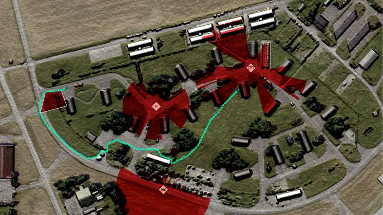
Carmenta today announced a new integration between Carmenta Terrain Router and ROS (Robot Operating System), enabling uncrewed ground vehicles (UGVs) to recalculate routes onboard during missions. By combining terrain data, tactical constraints and real-time observations, the integration helps autonomous vehicles adapt to changing conditions, helping improve mobility and enhance survivability in contested environments.
The growing use of UGVs in military operations has highlighted the need for autonomous systems that can respond to changing conditions without relying on continuous communications. Experience from the war in Ukraine has demonstrated how quickly terrain accessibility, obstacles and tactical conditions can change during a mission.
To address this challenge, Carmenta has integrated its terrain routing technology with ROS 2 Navigation 2 (Nav2), a widely used open-source autonomy framework. The integration makes advanced terrain-aware route planning available directly within the vehicle's autonomy stack, enabling routes to be updated as new information becomes available.
"Autonomous vehicles are already good at avoiding obstacles and navigating locally, but mission-level route planning needs to consider more than just the local environment," said Tobias Moberg, CTO at Carmenta. "By bringing tactical routing onboard, vehicles can continuously reassess their route using both geospatial intelligence and observations from the operational environment."
The integration enables route calculations that combine geospatial data, mission objectives and tactical considerations such as no-go areas, enemy observation and engagement zones, and preferred movement corridors. These factors can be continuously updated using observations from onboard sensors.
The solution also supports the use of continuously updated mobility information. When a vehicle encounters terrain conditions that differ from available map data, those observations can influence future route calculations and improve subsequent route choices. The information can also be shared with other platforms operating in the same area, creating a more up-to-date understanding of terrain conditions across a fleet.
About ROS 2 Navigation 2
ROS 2 Navigation 2 (Nav2) is a widely used open-source autonomy framework that provides path planning, navigation, path following and obstacle avoidance capabilities for autonomous and uncrewed systems.
Press release in Swedish available in related media.
Related links
Topics
Regions
About Carmenta
Carmenta provides software tools for visualizing and analyzing dynamic geospatial information in mission‑critical applications. Carmenta’s products are used across the world by system integrators and system providers in the defense, uncrewed systems, maritime, and public safety sectors. Headquartered in Sweden, Carmenta has subsidiaries in Germany, France, the UK and the US.