Pressmeddelande -
Topocad 15 – the next generation
Adtollo is releasing a new version of Topocad – Topocad 15. A version that has been developed during 2013 and containing several enhancements compared to previous versions. For example Topocad 15 has a brand new interface, is released with a 64 bit version using a drawing format that is future proof and indexed spatially.
Topocad 15 is a
Topocad-version in a renewed package. The interface enables a new way of
navigating through commands using ribbon bars and panels. “In Topocad 15 the
users can dock their dialogs”, says Tomas Sandström, director of Surveying
& Mapping at Adtollo. “The dockable dialogs enlarge the drawing
surface and creates a bigger working space on the screen”, Tomas Sandström
continues. The new interface also enables the user to fixate their most used
commands – so that they can be rapidly accessed.
Get a good large-file-work flow with a 64 bit version
Topocad 15 is launched in a 32 bit version as well as in a 64 bit version. The 64 bit version offers a greater memory capacity and simplifies working with large files, especially large raster images and point clouds.
In addition the drawing format in Topocad 15 is expanded. The TOP-format has been developed, enhanced and is now labeled TOPX. “In Topocad 15 we have focused on the new demands and ways of working with objects instead of points and polylines. Topocad 15 is fit for the future”, states Tomas Sandström. “The TOPX-format includes several advantages. For example we made room for three dimensional objects. Also, damaged files can be handled after say a crash”, Tomas Sandström continues.
Drape point clouds with raster images or skew a tunnel theoretic section
In Topocad 15 the Tunnel module is included in Volume Section and manages point clouds. Tunnel cross section can use ellipses and allow a tunnel theoretic section to be skewed. A quick section template command is a new feature and for the tunnel sections there are many different ways of calculating volumes in and outside the theoretic section.
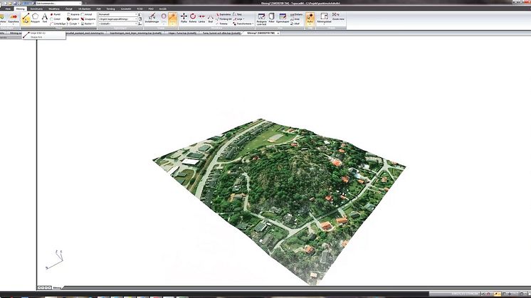
The Point Cloud module has also been developed containing features such as the possibility to drape the point cloud with raster images, manual erase of parts of the point cloud and a new feature to colorize the point cloud from elevation and/or declination.
Several commands have also been added and/or improved. Such as CAD-commands and functions for calculating objects. “We have also added a new way of transforming maps for different coordinate systems”, says Tomas Sandström. Topocad 15 uses Proj4/GDAL where all systems specified with EPSG-codes can be transformed.
Adtollo has been developing Topocad for 20 years and now Topocad 15 is introduced – the next generation.
Topocad 15 is released in the middle of February 2014.
Relaterade länkar
Ämnen
- Data, Telekom, IT
Kategorier
- adtollo
- gis
- mapping and surveying
- surveying
- mapping
- cad
- topocad
- topocad 15
Adtollo develops software for those who build society. Our systems help you with project, drawing and document management, surveying and CAD – and to bring order to your chaos.