Press release —
DJI Returns to INTERGEO with Drone Solutions for Mapping, Modeling and Inspecting
Enterprise Products on Display to Showcase how Geospatial and Inspection Professionals can Complete Tasks more Efficiently, more Safely, and more Reliably
DJI, the world’s leader in civilian drones and creative camera technology, is returning to INTERGEO, 10th-12th October, for the first time since 2020 to give survey and geodesy professionals insights into its very latest surveying solutions. Presentations will also be given on ‘Unlocking Precision - Elevating the Power of Drone Lidar Data for Accurate Surveys’, ‘Complete Workflow Solutions: Empowering the Geospatial Industry with DJI Enterprise’ and ‘Opportunities for effective data acquisition for the Digital Twin.’
Presentation Schedule
| Date & Time | Presentation | Location |
| Tuesday 10th October 15:00-15:30 CEST |
Unlocking Precision - Elevating the Power of Drone Lidar Data for Accurate Surveys | DJI Enterprise Booth: C27.54 |
| Wednesday 11th October 10:30-11:00 CEST |
Unlocking Precision - Elevating the Power of Drone Lidar Data for Accurate Surveys | DJI Enterprise Booth: C27.54 |
| 14:30-15:00 CEST | Unlocking Precision - Elevating the Power of Drone Lidar Data for Accurate Surveys | INTERGEO Unmanned Systems STAGE: Hall 3.2 / C3.008 |
| 15:00-15:30 CEST | Complete Workflow Solutions: Empowering the Geospatial Industry with DJI Enterprise | Terrasolid Booth A25.70 |
| Thursday 12th October 10:00-10:15 CEST | Opportunities for effective data acquisition for the Digital Twin | INTERGEO Unmanned Systems STAGE Hall 3.2 / C3.008 |
| 10:15-10:30 CEST | Complete Workflow Solutions: Empowering the Geospatial Industry with DJI Enterprise | INTERGEO Unmanned Systems STAGE Hall 3.2 / C3.008 |
Visitors to the booth during 10th-12th October, will be treated to seeing how DJI’s pioneering enterprise products are able to help them perform their tasks more efficiently, more safely, and more reliably.
DJI Mavic 3 Enterprise Series
The Mavic 3 Enterprise Series redefines industry standards for small commercial drones. With a mechanical shutter, a 56× zoom camera, and an RTK module for centimeter-level precision, the Mavic 3E brings mapping and mission efficiency to new heights.
DJI Mavic 3M
Effective aerial surveying needs to see the invisible. That's why Mavic 3 Multispectral has two forms of sight. It combines an RGB camera with a multispectral camera to scan and analyze crop growth with total clarity. Agricultural production management requires precision and data, and Mavic 3M delivers both.
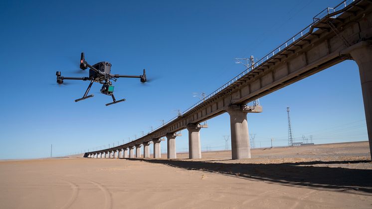
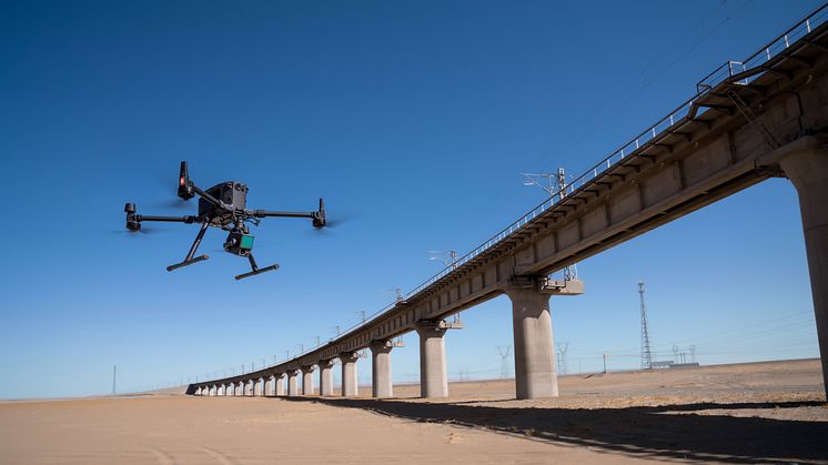
DJI Matrice 350 RTK
An upgraded flagship drone platform, the Matrice 350 RTK sets a new benchmark for the industry. This next-generation drone platform features an all-new video transmission system and control experience, a more efficient battery system, and more comprehensive safety features, as well as robust payload and expansion capabilities. It is fully powered to inject innovative strength into any aerial operation.
Zenmuse P1
The Zenmuse P1 integrates a full-frame sensor with interchangeable fixed-focus lenses on a 3-axis stabilized gimbal. Designed for photogrammetry flight missions, it takes efficiency and accuracy to a whole new level.
Zenmuse L1
The Zenmuse L1 integrates a Livox Lidar module, a high-accuracy IMU, and a camera with a 1-inch CMOS on a 3-axis stabilized gimbal. When used with Matrice 300/350 RTK and DJI Terra, the L1 forms a complete solution that gives you real-time 3D data throughout the day, efficiently capturing the details of complex structures and delivering highly accurate reconstructed models.
DJI Dock
DJI Docks are rugged, reliable, and are built to operate 24/7, day or night, rain or shine. Each DJI Dock houses a Matrice 30 where it lands, recharges, takes off, and executes missions programmed in DJI FlightHub 2.
DJI Terra
DJI Terra is 3D model reconstruction software that has photogrammetry as its core technology. It supports a range of accurate and efficient 2D and 3D reconstruction of visible light, and data processing through DJI LiDAR. DJI Terra is a perfect match for DJI Enterprise drones and payloads. It works in conjunction to build a complete application solution that caters to verticals such as land surveying and mapping, power transmission, emergency services, construction, transportation, and agriculture.
Booth Location: C27.54 (Main Entrance, Hall 27)
Full floor plan: https://bit.ly/INTERGEOfloorplan
For more information or to arrange an interview, please contact: pr@dji.com
Topics
Since 2006, DJI has led the world with civilian drone innovations that have empowered individuals to take flight for the first time, visionaries to turn their imagination into reality, and professionals to transform their work entirely. Today, DJI serves to build a better world by continuously promoting human advancement. With a solution-oriented mindset and genuine curiosity, DJI has expanded its ambitions into areas such as agriculture, public safety, surveying and mapping, and infrastructure inspection. In every application, DJI products deliver experiences that add value to lives around the world in more profound ways than ever before.
For more information, visit our:
Website: www.dji.com
Online Store: www.store.dji.com
Facebook: www.facebook.com/DJI
Instagram: www.instagram.com/DJIGlobal
Twitter: www.twitter.com/DJIGlobal
LinkedIn: www.linkedin.com/company/dji
Subscribe to our YouTube Channel: www.youtube.com/DJI