Image —
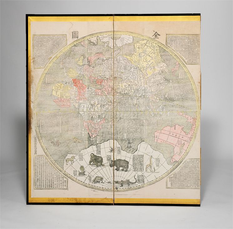
Great Universal Geographic Map (1860)
Ferdinand Verbiest 1623-1688, after: "Kun Yu Quan Tu" - Great Universal Geographic Map, a handcoloured xylograph depicting the Western and the Eastern hemisphere, each printed in three sheets and mounted on two panels. This map was reprinted in Canton and dated Xianfeng Gengshen - 1860. Each panel c. 175 x 80 cm. Each sheet c. 161 x 52 cm. Estimate: DKK 400,000 / € 54,000
Bruun Rasmussen Auctioneers
- License:
- Creative Commons Attribution, no derivatives
With a Creative Commons license, you keep your copyright but allow people to copy and distribute your work provided they give you credit. You permit others to copy, distribute and transmit only unaltered copies of the work — not derivative works based on it.
- By:
- Bruun Rasmussen Auctioneers
- File format:
- .tiff
- Size:
- 5794 x 5685, 64.9 MB
