Gå videre til innhold
Blue Insight 3D visualization. The echogram shows a zooplankton layer in green

Pressemelding -

Blue Insight - Expanding the digital toolbox to support ocean economies

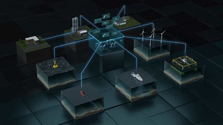
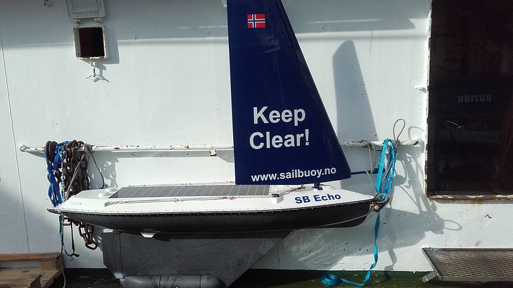
Akvaplan-niva has signed a contract with Kongsberg Maritime and ConocoPhillips to further expand the capabilities of the digital infrastructure "Blue Insight" (BI). The aim is to better serve the requirements for ecosystem monitoring that ocean industries meet. The collaboration builds on the established relationship in the GLIDER II project financed by ConocoPhillips. While the first part of the GLIDER project focused on real time 2D and 3D visualization of ocean data in a dedicated Ocean View module, the last phase has a longer time span and an increased focus on efficient data management. This will optimize Blue Insight and give Akvaplan-niva a more holistic tool when offering services to increase economic value and safe environmental operations for all ocean-based activities.

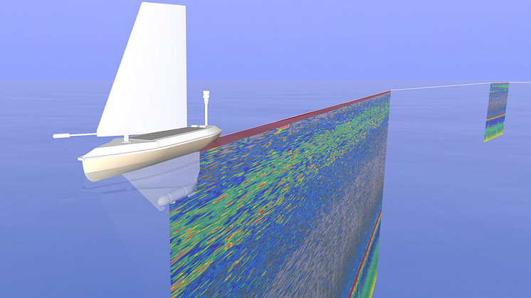
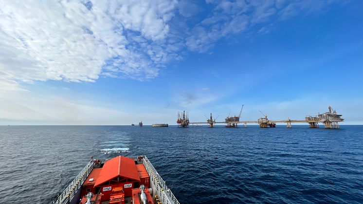
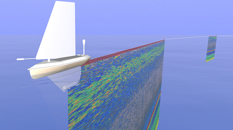
During 2021 the work on the digital infrastructure focused on setting up the BI environment and advancing the multi-platform operation and data visualization. The latter were realized in 2D map projections as well as 3D environments that also include relevant offshore assets together with external information-bearing background layers. Tracks of vehicles (like gliders) can be displayed together with measuring data and additional features such as AIS supported positions of vessels in the vicinity, all tremendously supporting contextualization when performing monitoring tasks.

Due to the intensification of the joint collaborative efforts, there has been an increase in the team of dedicated programmers in the project. While further enhancing the visualization capabilities (i. e. the Ocean View module) remains an important focus, there is also an emphasis on data management in the broadest sense, comprising the elements of data flow, sharing, quality control and analysis.

The visualization work will improve several aspects related to comprehensive and seamless 4D data and vehicle track displaying as well as cover application specific dashboards. The work on data flow will introduce an advanced data indexing and cataloguing environment for improved searchability of the growing amount of data. Further, the realization of automated data pushes to selected stakeholders by using the Data Forwarder Module, will demonstrate efficient data sharing. Conductivity and temperature data from the glider vehicles will be shared in real-time with the Norwegian Meteorological Institute for automated assimilation in physical ocean modelling (Norkyst).

For an advanced digital infrastructure to optimize the handling of ocean data, it is important to include automated data quality control and analysis. A central element in this context will be the realization of a cloud-based processing environment with the possibility for external input of custom-made analytical code in different programming languages. Data analysis will be further addressed through the implementation of an in-cloud classifying framework used for the processing of the echo sounder data.

The deep domain knowledge, close partner collaboration and a clear focus and dedication, now materializes in steadily enhancing the efficiency of complex monitoring missions in the interest of customers and stakeholders. As part of this process Akvaplan-niva has already been using Blue Insight successfully in environmental monitoring projects at the Polar Front and within a floating wind park, both on behalf of the energy sector and as part of international research projects (e.g. http://www.bioglider.eu/).

Kongsberg press release: https://www.kongsberg.com/mari...

Emner

Kategorier

Kontakter

  • Blue Insight illustration
    Blue Insight illustration
    Lisens:
    All rights reserved
    Filformat:
    .png
    Opphavsrett:
    Akvaplan-niva
    Størrelse:
    2114 x 1044, 1.73 MB

Relatert innhold

  • Sampling around the Polar Front is not without danger. (Photo: Nathalie Morata)

    Akvaplan-niva leading new project on Polar Front ecology

    Akvaplan-niva has been awarded funding from the Research Council of Norway to study the role of the Polar Front in ecosystem structure and function in the western Barents Sea. The project has contributions from two petroleum companies, and logistical support from UiT The Arctic University of Norway and an EU project (BioGlider). The project period is November 2021 – December 2024.
    The Barents S

  • Kongsberg Maritime has launched Blue Insight, a modular, cloud-based solution for seamless data collection and analysis (Illustration: Kongsberg Maritime).

    Akvaplan-niva collaborates as Kongsberg Maritime launches a digital toolbox for ocean data management and analysis - Blue Insight


    Blue Insight provides an open, modular platform for the processing, visualisation and sharing of ocean data. The core module contains the cloud framework – which has been built to the highest cyber security standards – and an application-specific dashboard, teamed with data storage and management functionalities. Additional modules can be added to this framework to tailor Blue Insight’s functi

  • PolarFront gjengen fra Akvaplan-niva på tokt. Eva Leu (nr to fra venstre bakerst) er ekspert på alger

    Algene i ishavet nyter våren


    Algene i Barentshavet blomstrer og er fornøyde, sier forskerne. Det er godt nytt for alle dyrene som lever der.
    Algene i ishavet nyter vårenFOTO: ROLF GRADINGER/ UIT

    Alger er havets planter. De bruker sollys for å lage oksygen og energi fra karbondioksid og andre stoffer i havet. Algene i havet lager rundt halvparten av oksygenet på jorda. De er også livsgrunnlaget for dyr, fisk

  • Akvaplan-niva anvender havdronen "seilbøye" til ulike miljøkartleggingsprosjekt.

    Miljø DNA - en månelanding innen miljøovervåking

    Hvert år brukes millioner av kroner på å overvåke og kartlegge norsk natur for å kartlegge ulike parasitter i vannmiljø, for eksempel Gyrodactylus salaris. For en mer ressurs-effektiv kartlegging ble det for tre år siden igangsatt et arbeide for å utvikle en løsning for automatisk miljøovervåking ved hjelp av miljø-DNA. Nå i oktober demonstrertede to gjenværende konsortiene i den såkalte før-komme

  • Foto: Eva Leu/Akvaplan-niva

    Hva skjer på et forskningsfartøy?

    Forskerne i PolarFront er på tokt med FF Helmer Hanssen for å forske på livet i den polare fronten i Barentshavet. De forsker på livet i havet gjennom å ta prøver og bruke avansert teknologi.


    Av: Thode, Sunniva Katharinasunniva.k.thode@uit.no 

    PolarFront forsker ved iskanten i Barentshavet.FOTO: SUNNIVA KATHARINA THODE/UIT
    Når forskerne skal undersøke områder som er vans

  • Skandi Nova shooting near Ekofisk installations (Photo: Magseis Fairfield).

    Multiple technologies in North Sea environmental research

    Akvaplan-niva has been leading a mission to collect environmental data near the offshore facilities in the Greater Ekofisk Area, in the North Sea. The mission was part of the Glider II project financed by ConocoPhillips Scandinavia AS. This was a complex collaboration effort between the industry, ConocoPhillips Scandinavia AS and its subcontractor Magseis Fairfield, Akvaplan-niva and the Norwegian