Press release -
New 3D maps give disabled Southern, Thameslink, Great Northern and Gatwick Express passengers more independence at stations
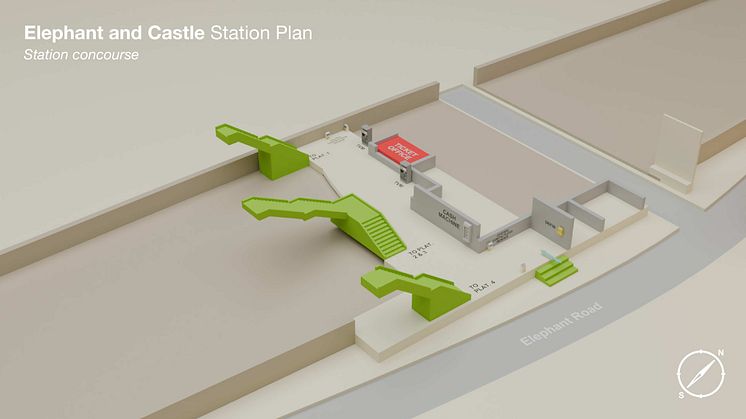
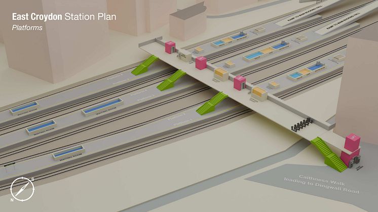
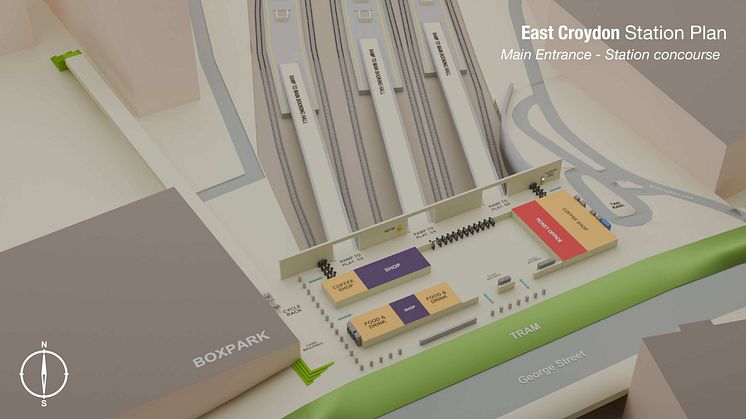
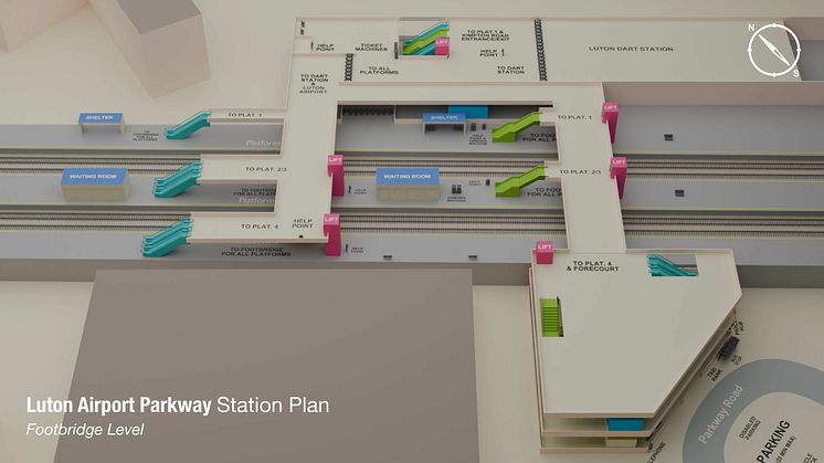
- Stations include (see photos): Brighton, City Thameslink, Denmark Hill, East Croydon, Elephant & Castle, Finsbury Park, Gatwick Airport, London Blackfriars, Luton Airport Parkway and Peckham Rye
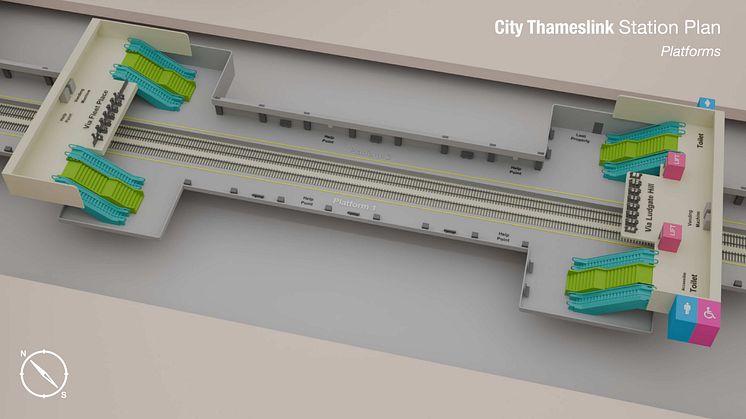
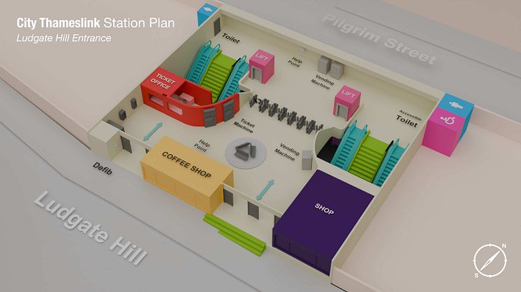
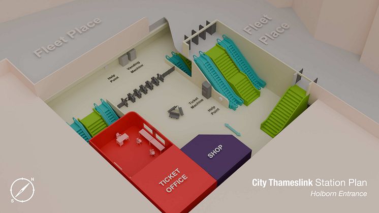
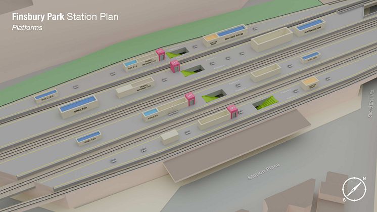
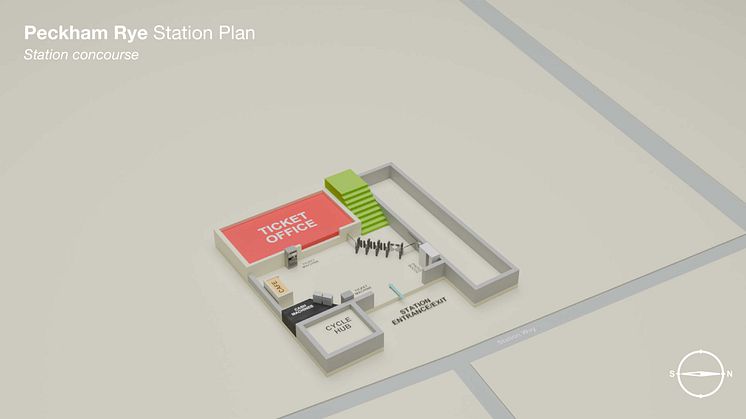
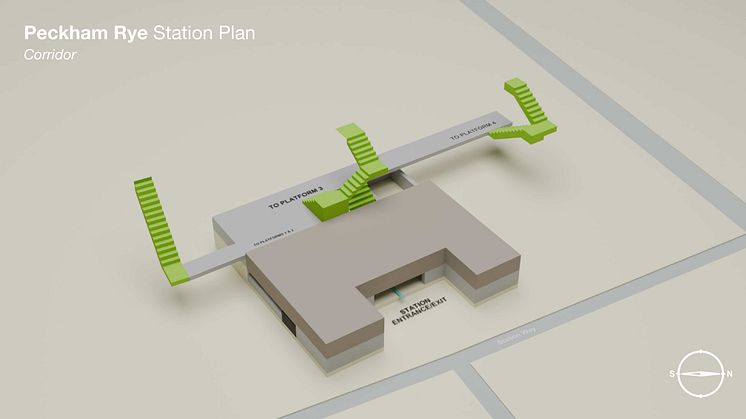
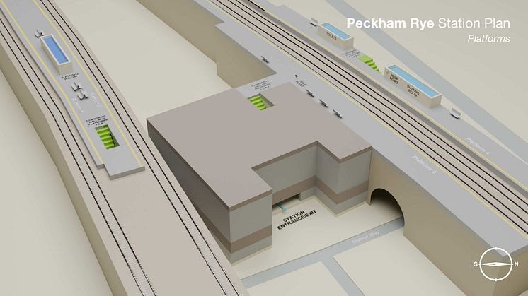
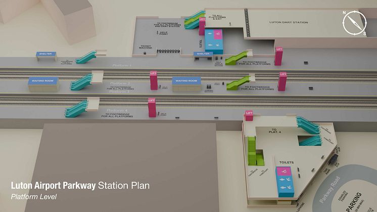
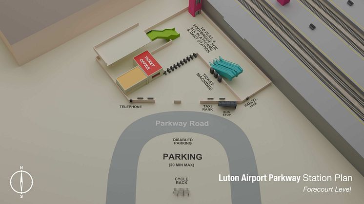
Three-dimensional maps of key stations in London, Sussex and Bedfordshire have been created by the country’s largest train operator to help passengers, and particularly those who are disabled, gain more confidence in navigating its stations with ease.
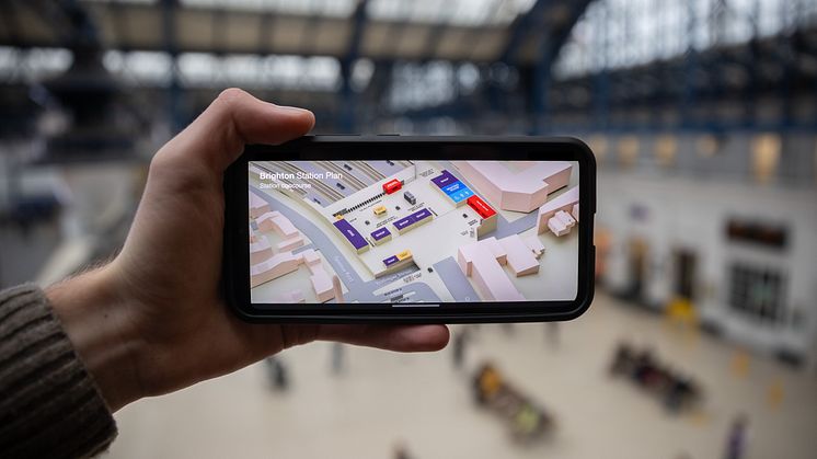
Passengers will be able to plan their journeys through select stations in the South East operated by Govia Thameslink Railway (GTR) using new digital 3D maps on their mobile phones and computers.
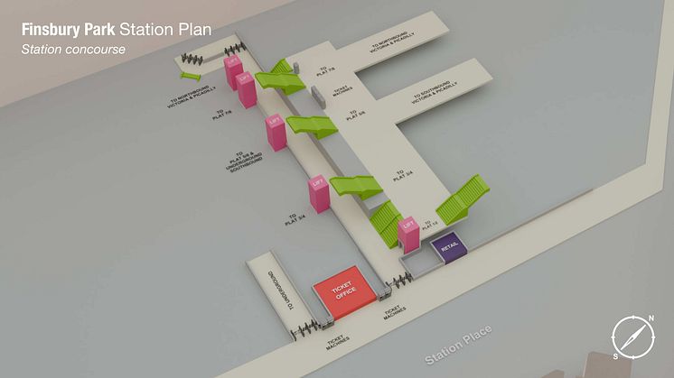
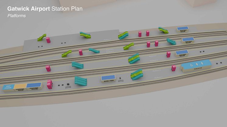
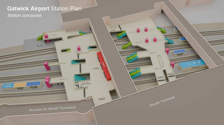
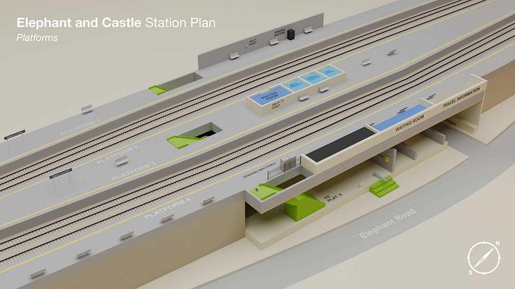
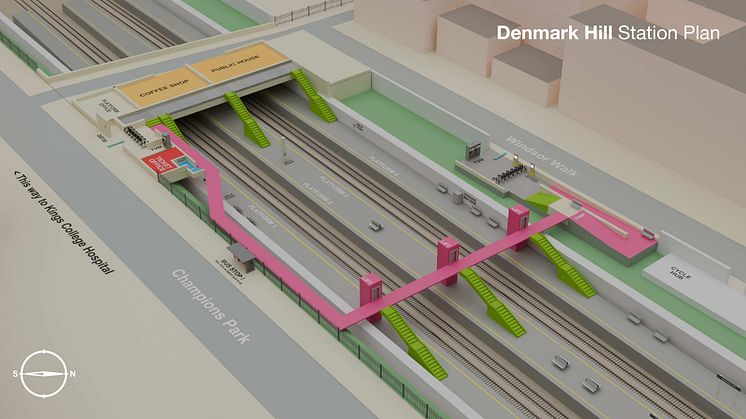
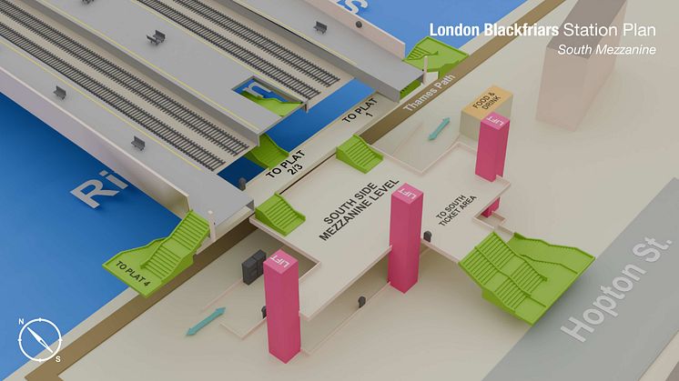
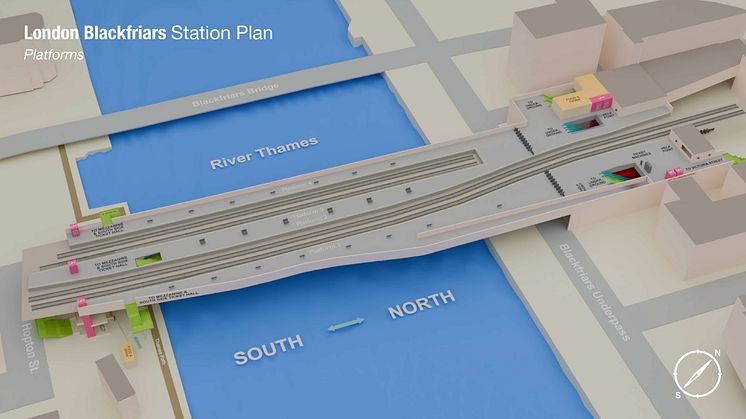
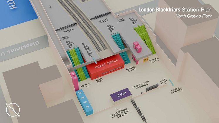
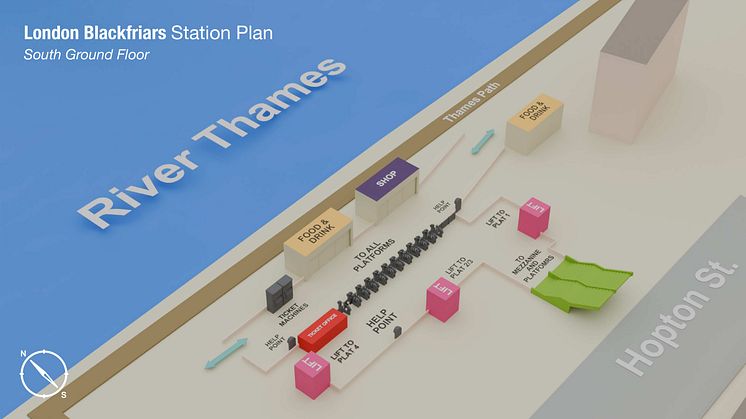
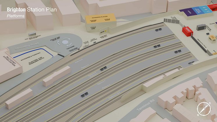
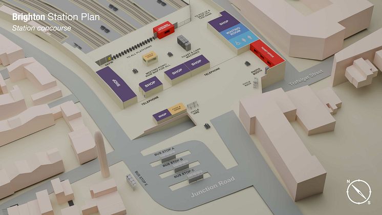
The scheme, which is being trialled at 10 stations, makes it easier for disabled passengers to identify staircases, lifts, and ticket gates on a bespoke aerial map of the station, so journeys can be planned from street to seat before the trip even starts.
Carl Martin, Govia Thameslink Railway’s Accessibility Lead, said: "We understand that for some of our customers, visiting a new station can feel overwhelming.
“Whether it’s finding essential facilities or navigating between platforms, our goal is to ensure everyone can travel independently and with confidence, regardless of their access needs.
“We’re really pleased to introduce these new maps as part of our commitment to create a more inclusive and accessible railway. Together with other helpful guides on the assisted travel pages of our websites, they'll help people plan a smooth and stress-free journey.”
Currently, bird’s-eye-view maps exist of every station served by GTR, but feedback has found that some of these could be improved, as they were not to scale and sometimes difficult to navigate at a glance – especially at larger stations.
The new diagrams show colour-coded accessible routes, steps, and clearly show the various levels to a station. They can be accessed through National Rail Enquiries, or on the website of all GTR’s train brands.
The first 10 stations to be mapped in 3D are:
- Brighton
- City Thameslink
- Denmark Hill
- East Croydon
- Elephant & Castle
- Finsbury Park
- Gatwick Airport
- London Blackfriars
- Luton Airport Parkway
- Peckham Rye
The locations were selected with input from disabled members of GTR’s access advisory panel, which helps the company make its services more accessible.
Locations were selected based on footfall and complex layouts, such as multiple levels and different entrances. For example, Denmark Hill was chosen due to its proximity to the King’s College Hospital.
If the trial is positively received by users, there is an opportunity for more stations to be mapped and added to the scheme.
ENDS
Topics
Categories
For more information, contact the press office on 0203 750 2031.
Govia Thameslink Railway
Govia Thameslink Railway (GTR) operates Thameslink, Great Northern, Southern and Gatwick Express services as follows:
- Thameslink – cross-London services between Bedford/Peterborough/Cambridge and Brighton/Horsham/East Grinstead, and between Luton/St Albans and Sutton/Wimbledon/Rainham; plus services between London and Sevenoaks
- Great Northern – services between London and Welwyn, Hertford, Peterborough, Cambridge and King’s Lynn
- Southern – services between London and the Sussex coast (Brighton, Worthing, Eastbourne, Bognor Regis, Hastings) and parts of Surrey, Kent and Hampshire (Ashford International, Southampton, Portsmouth)
- Gatwick Express – fast, non-stop direct services between Gatwick Airport and London Victoria
www.southernrailway.com, www.thameslinkrailway.com, www.gatwickexpress.com, www.greatnorthernrail.com

